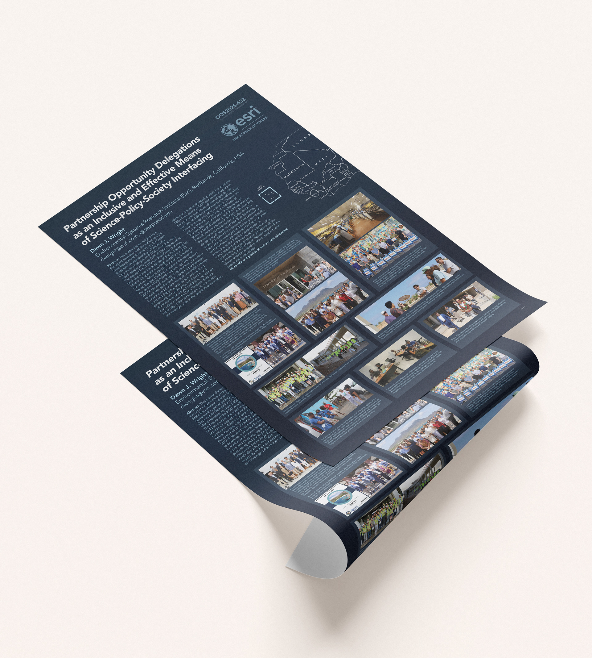
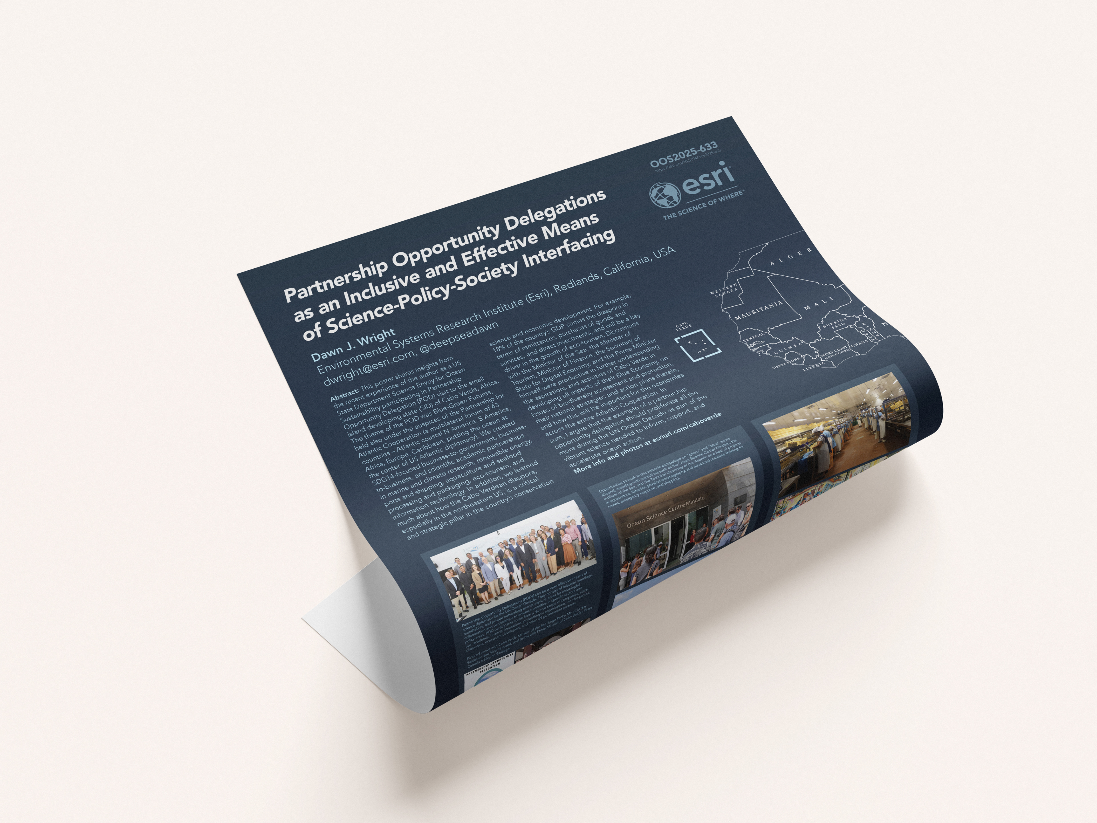
Scientific Poster Design for Dawn J. Wright’s Presentation at the UN One Science Congress
This project involved the conceptualization and design of a scientific poster to support Dr. Dawn J. Wright’s presentation at the United Nations One Science Congress. The primary objective was to translate complex geospatial and ocean science research into a visually compelling and accessible format for a diverse, global audience that included policymakers, scientists, and international stakeholders.
A scientific poster is a visual communication tool commonly used in academic and professional conferences to present research findings in a concise, structured, and engaging format. Unlike full-length papers, posters rely on a combination of brief text, graphics, and data visualizations to quickly convey key ideas, methods, and conclusions, allowing viewers to grasp essential information at a glance.
The poster was designed to communicate key themes from Dr. Wright’s work, including ocean mapping, digital transformation of marine science, and the importance of data-driven decision-making for sustainable ocean management. Emphasis was placed on clarity, visual hierarchy, and storytelling—ensuring that critical insights could be quickly understood in a high-level conference setting.
The design process integrated cartographic elements, data visualization, and clean typographic structure to balance scientific rigor with visual engagement. Color schemes and graphical motifs were carefully selected to reflect oceanic themes while maintaining accessibility and readability. Infographics and maps were used to distill complex datasets into intuitive visuals, supporting the narrative without overwhelming the viewer.
Given the international platform of the UN One Science Congress, the poster also needed to resonate across disciplines and cultural contexts. As such, the design prioritized universal visual language, minimal jargon, and a logical flow of information from problem statement to solution and impact.
This project highlights the role of design as a bridge between science and communication—demonstrating how thoughtful visual strategies can amplify the reach and impact of scientific research on a global stage.